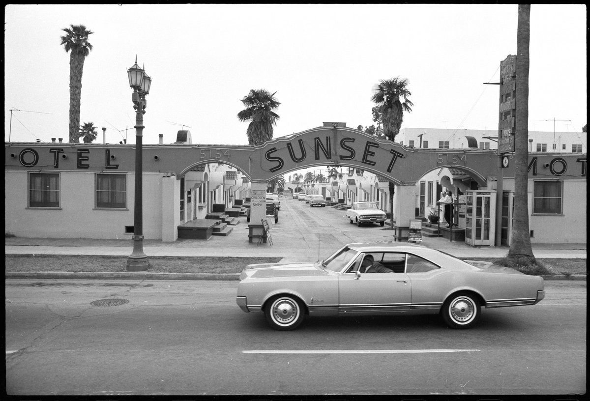
Before Google Street View, there was Ed Ruscha. In 1966, the Los Angeles artist first drove along the Sunset Strip with a motorised camera mounted to the back of his truck, using it to photograph the entire street in a manner that uncannily predicted today’s online mapping technology. He compiled the images in his book, aptly titled Every Building on the Sunset Strip, then he repeated the effort over at least a dozen rides between 1966 and 2007, documenting the entire length of Sunset Boulevard, from the beach in the Pacific Palisades to the west to downtown Los Angeles in the east. Earlier this week, the Getty announced that it had pulled together 65,000 of Ruscha’s images online in 12 Sunsets: Exploring Ed Ruscha’s Archive, an interactive database that lets you virtually drive along with the artist.
“I looked at Sunset Boulevard like a 22-mile-long canvas, with an evolving history,” Ruscha told the Los Angeles Times. “It had fluid motion, fluid stories, one long horizontal ribbon, and I always thought about it. It just asked to be documented.” The 82-year-old artist added that he plans to continue the project as “soon as this whole coronavirus lifts”.
Using the up and down arrow keys to change years and the left and right arrow keys to drive east and west, 12 Sunsets begins by dropping you off at the old Tower Records in West Hollywood (fast forward to 2007 to see the now bankrupt record store boarded up) and lets you take the wheel from there. Cruise through a pre-Getty Bel Air on your way to the beach, stop by the Viper Lounge or spot some old marquees at the Whisky a Go Go. Buckle up!


